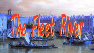
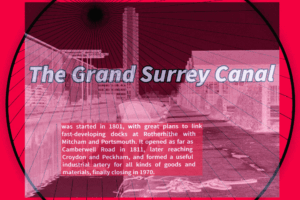
The canal’s full title to begin with was the Croydon and Rotherhithe Canal, in anticipation of a direct link to the Thames. The Croydon Canal, as it finally became known as, opened at the same time as the Grand Surrey in 1809. It was swept away by the new line from London Bridge to Croydon in 1836. Several lengths unsuitable for the railway survived a little longer and carried on trading (the receipts from boat traffic in 1837 were surprisngly higher than those in the previous half year on a canal that had offically closed!) It is possible this trade was in fact transportation of materials for the building of the railway. These remaining lengths were used for pleasure boating, especially around Anerley.The rapid spread of surburbia took away these sections and the Croydon Canal became all but a name.
This guide shows where the canal once went and what is left. The survey of the route and photography for the guide took me on an amazing walk though South London’s surburbs, presenting a slice of social history and finding that the canal had indeed been a picturesque one.It is fair to say that the Croydon Canal was indeed the most exciting waterway in South East England. It had the most locks (including a staircase.) The dramatic ascent of 28 locks in just two and a quarter miles is a record few other canals can claim, especially with regards to broad locks. In this respect it puts the Hatton flight of 21 locks, the Grand Union Canal’s ‘Stairway to Heaven’ into pale significance, and it is perhaps time to view some of these canal ‘record breakers’ in a different light, because they werent that special after all.
The Croydon is easily the most non-existent ‘lost canal,’ compared to other lost urban waterways, but we have to be fair, considering it was closed nearly two centuries ago. There are three sections that still remain – Dacres Wood, a traceable but dry, section at Norwood, and of course the Betts Park stretch.
The easier bits – eg the sections such as at Anerley, Betts Park, Dacres Wood, Norwood, and along roads such as Devonshire, and Davidson Roads, or the section around the Grand Surrey, can be seen utilising short walks and the railway, or buses as a full day may not be enough. In late 2003 a mural was enacted at Davids Road in Forest Hill in recognition of the former existence of the canal.

The NEW way to explore the entire canal route between Rotherhithe and West Croydon.
The extended East London Line services from Higbury & Islington/Dalston Junction to West Croydon makes it easier to explore what basically was the complete, original, route known as the Croydon and Rotherhithe Canal. The picture shows the first train used to launch the new services on 27 April 2010, seen leaving Surrey Quays station for New Cross
Bibliography & References: Lost Navigations – The Croydon and Grand Surrey – Bernard Brown, Canal and Riverboat, 1986; Retracing Canals to Croydon and Camberwell – Living History Publications, Bromley, 1986; South Norwood and the Croydon Canal – Ken Maggs and Paul De Athe, North Downs Press, Westerham, 1984; The Croydon Canal – A Dissertation by Peter Gow, 2000.
Many thanks to: Croydon Local Studies Library for their help and use of images from the library collection and Goldsmiths College for permitting photographs to be taken of the canal route through their grounds.
THE CROYDON CANAL PAGES:
hatcham / new cross / barriedale / shardeloes rd / brockley & honor oak / forest wood / davids rd / forest hill & sydenham / dacres wood & venner rd / penge & anerley / betts park & norwood / towpath way / spurgeons br / west croydon / route maps