The canal by where Canary Wharf now stands
The Isle of Dogs canal as it was popularly known, was the third canal to be built in London following the Limehouse Cut of 1770 and the Grand Junction’s Paddington Arm of 1801. The City of London Corporation’s West India Docks Act of 1799 permitted the construction of a canal across the Isle of Dogs, an area which is now dominated by the Canary Wharf scene. The canal was a means of avoiding the sometimes difficult stretch of river around the Isle of Dogs and was officially opened on 9th December 1805. The total cost was £168,813. The original title of City Canal was an odd choice since it wasnt located in the City of London, rather it was an annexe of sorts, which is why it was also known as the Isle of Dogs canal and it is described as such by Joseph Priestly in his vast tome on the country’s canal system, for rightly as Priestly points out, the Act describes it as “the Canal across the lsle of Dogs…”
The canal’s demise was a simple matter concerning the tides on the river. Despite its usefulness as a short cut the tides often meant it was quicker to sail around the Isle of Dogs peninsula itself. The canal was sold to the West India Dock Company in 1829 for £120,000. Between 1866 and 1870 it was rebuilt as the South West India Dock. Its now known as the South Dock and is the longest, and largest expanse of water, to the south of the Canary Wharf complex. The original eastern lock entrance was rebuilt in 1931. The western entrance is still visible with its original walls and lock recesses, and it serves as the Impounding Dock. This facilitates the means by which the water levels are maintained in the Canary Wharf area, and the pumping system is operated by British Waterways, who took over the management of the entire Isle of Dogs dock complex and entrance lock in 1997.
The Isle of Dogs was little known to most people until the building of Brunel’s famed SS Great Eastern took place here in the 1850’s. Some very strange aspirations were assumed about the populace living on the Isle of Dogs: “the island is peopled by a peculiar amphibious race, who dwell in peculiar amphibious houses, built upon a curious foundation, neither fluid nor solid.” This was probably exacerbated by the fact that it was difficult to access the area because it meant crossing bridges which ever way one headed, and many of these bridges were frequently open to shipping and docks traffic. Modern day ‘Docklands’ has seen to it that a new roads network has been built and more notably, the Docklands Light Railway which opened in 1987 and which forms a major feature of the docks themselves, in several locations evoking memories of the Liverpool Overhead Railway.
This guide looks at the present scene today in South Dock, going westwards from West India Dock Entrance Lock (sometimes known as Blackwall Lock) to Limehouse Lock on the other side. The extremities offer the most canal related scenes, whereas the remainder of the route is redeveloped waterspace and high intensity office development that has little bearing on the actual history of the City or Isle of Dogs canal itself.
The Blackwall reach entrance to South Dock (built upon the original Isle of Dogs Canal lock site) with its distinctive blue lift bridge and the modern British Waterways’ lock keepers’ control cabin. The Canary Wharf complex and some of the cranes left over from commercial dock working days can be seen. Special permission was obtained from BW for taking this picture.
This is a view looking westwards along the large lock, showing the outer and inner sets of gates. The outer sets of gates are rarely used these days.
The ‘skyscrapers’ (our little things compared to other cities of the world’s megastructures!) can be seen clearly dominating the skyline. There’s little reason to discuss the buildings themselves, other than to say that No 1 Canada Place, Canary Wharf (which is the tallest of the group at 800 feet) can be seen clearly with its pyramid summit, flanked by the Citi Corp and HSBC buildings.
The sets of buildings on the left (south of Canary Wharf) are the newer structures at Heron Quays. It is these we will have a little bit of interest in, for these straddle the original Isle of Dogs canal route. When South Dock was built it was placed such that the original entrance locks to the canal were diagonally opposite at the top western and the bottom eastern corners of the dock.
The Heron Quays development has encroached on the northern section of South Dock so that its width has been considerably reduced and the old canal alignment now runs through the most southermost of the Heron Quays skyscrapers. Its all a bit difficult to explain from this viewpoint.
A view looking westwards along South Dock. If one were to draw a line down the centre of this picture so that it could be folded, the line would bisect the southernmost tower of the Heron Quays complex. It would clearly demonstrate how much the dock itself and orginal canal alignment has been encroached upon by the Heron Quays complex. was built on the Clyde and is preserved at South Dock")
Portwey (after PORTsmouth and WEYmouth) was built on the Clyde in 1927 and is preserved as a working exhibit at South Dock. The blue lift bridge and the O2 (Millenium Dome) can just be seen in the background.
This is a view looking east at the junction with the Milwall Dock. Both blue lift bridge and O2 can clearly be seen. The Isle of Dogs canal’s route took up the top (north) half of the waterway here. It’s width was doubled to form the South Dock.
This view looks from the Milwall Dock entrance westwards. The Isle of Dogs canal ran on the north side. The buildings comprising the Heron Quays development sit astride approximately the north half of the former canal alignment. But as mentioned before, the dock was built at a diagonal to the canal itself, so the further west one goes the more the Heron Quays complex encroaches the canal’s former alignment.
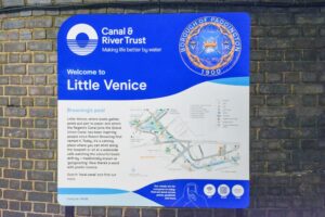
British Waterways name is stamped at many locations around Docklands, and these well maintained signs and lifebelts around Canary Wharf speak for themselves. Their counterparts on the canals themselves are not so well maintained, as as one can observe, despite many lifebelt posts on the intensively used section of canal between Little Venice and Camden there’s not one lifebelt available on that stretch.
A view looking back towards West India Dock entrance lock and bridge. The sinking yacht is called ‘Love-Love.’ it was made as part of a series of commissions on and around the Thames during October 2008. It’s definitely one boat that wont be castigated for being both unlicensed and a continuous moorer!
The extent to which the Heron Quays development encroaches South Quay becomes apparent in this picture. One can also deduct from this that most of the former alignment of the Isle of Dogs canal has now been built over.
An older style Docklands train for Bank crossing South Dock, the front end being just about on the alignment of the old canal route. The newer stock began operation just a few days after this was taken.
A view looking east from Marsh Wall along the canal’s alignment. In this view it is clear how much the development has encroached the original line of canal. The Docklands railway viaduct can be seen in the distance.
Just a short walk west from Heron Quays Docklands Railway station is this bus stop, sited opposite the City Pride pub, and which marks the entrance to Limehouse lock. Its now covered in part by the new section of road that forms part of Marsh Wall. Behind the shelter is the Pumping station, which was built by the Port of London Authority in 1929 to manage the water levels in the docks complex. Limehouse lock was considered the least important of the two locks, as it only carried some barge traffic, so it was converted into an impounding dock.
Far from the world of its scruffy, rather poorly maintained canals, is BW’s prestigious existence at Canary Wharf. Here’s a view of their pumping station (built in 1929 by the Port of London Authority) with the famous 800ft high Number One Canada Square building dominating the skyline. canal's Limehouse lock, now known as the impounding dock")
History reveals itself! The original Limehouse lock, in fact the oldest lock chamber in existence in this part of London! The 1805 lock chamber clearly seen, with Canary Wharf towering above. The lock was last used in the 1920’s before becoming an impounding dock.
The pumping house is a quite splendidly built red brick structure with a purpose of work. Nevertheless the arrangement is not ideal because it is clear that Canary Wharf has been deprived of a direct passenger ferry service to Central London, especially at a time when river travel is booming.
Original gate recesses. The large white ducting appears to be to do with the collection of water for the dock areas, it could do with a bit of care!
The end of the impounding dock, and the Thames behind. Some well known London landmarks can be seen, including the Gherkin, London Docklands Hilton and Columbia Wharf. The Canary Wharf pier – Hilton Docklands ferry is seen crossing towards its southern disembarkation point. Just out of sight at the top of the river is the entrance to Limehouse lock for the Regents Canal and the Lee Navigation.
Certainly some people must wish that this lock had been kept in use and the other one at Blackwall Reach had been decommissioned. This would have created a far more viable waterway network, with Limehouse Basin and the Regents Canal/Lee Navigation just a couple of minutes boating time away.
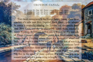
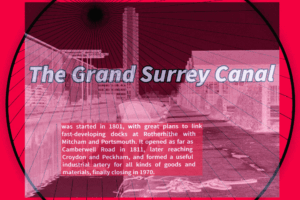
If the Port of London Authority had considerably more sense and kept the the Grand Surrey Canal open (the entrance was almost opposite Limehouse lock) there would have been even more opportunities for a water based transport system. It is clear that there was a definitive lack of vision upon the closure of London’s docks. Yes there are more homes than ever before because many docks have been filled in, but one could say that London has shat on itself by having to rely on alternative and often less effective transport system that doesn’t work so well as a comprehensive network around the Docklands area.