Romford Canal – The final section
The canal route passes through what is now known as The Chase nature reserve (Barking & Dagenham confusingly calls it Eastbrook End Park) After initially following the Beam River for a short distance above the railway at Elm Park, the canal changes route and follows the River Rom. The final three, or possibly even four, locks were clearly planned along this stretch. I say four as I think the builders would have had to construct a differently graded ascent through this section in order to match the lie of the land. To get an idea of the total amount of ascent required to climb to Romford, one only has to look at nearby Ilford Hill (in Ilford of course) where the difference in height between the River Roding and Ilford is all too apparent.
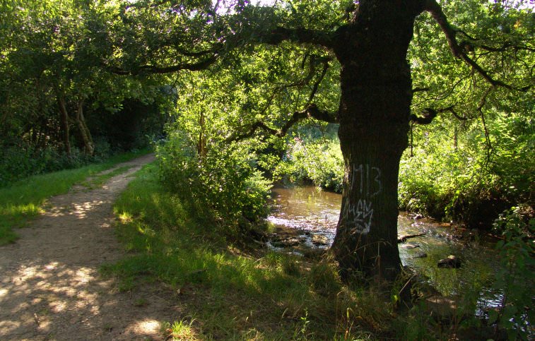
There is virtually no trace of the canal above The Chase (a public bridleway between the boroughs of Barking/Dagenham and Havering) because the Rom valley is very narrow and steep sided. Clearly the canal builders hadn’t done any work on what would have been the most expensive section of all to construct, with a number of locks and steeply sided embankments parallel to the River Rom. One bonus for the modern day canal explorer is that a considerable length of the canal channel here is clear of any undergrowth, and it twists and turns along the river valley, making it the most interesting of what remains of the Romford Canal.
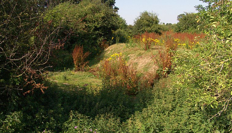
The canal’s dry channel in the Chase Nature reserve.
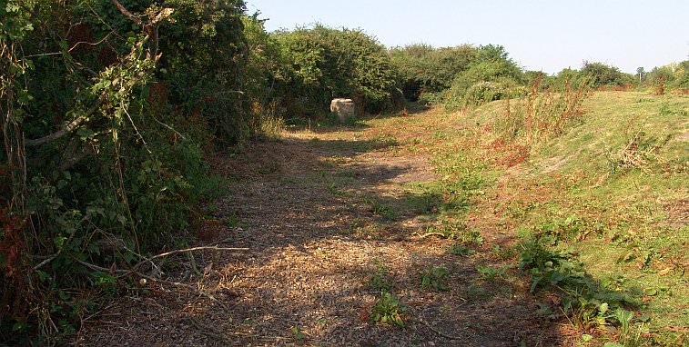
As one progresses northwards the canal’s route becomes even more apparent. One can walk along the canal’s bed for a good distance. This section of canal is not marked on any maps!

The canal’s channel as it heads towards Romford. The houses in the distance are situated on Rainham Road North. Canal not marked on any maps either…
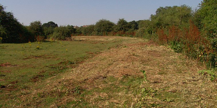
The canal sweeps round in a beautiful curve as it leaves the Beam River and joins the River Rom valley for the remainder of the run to Romford. One very noticeable thing as one progresses northwards, is that the earthworks for the canal become less evident, which indicates the amount of progress that had been made before construction ceased completely. In the above example, the canal side has only just begun to be built up to form the channel. A lot more work would have been needed to form the channel up to full height to provide the depth required for barges to navigate the canal. Certainly the Romford Canal has a special interest in terms of industrial archaeology – showing people of the 21st Century just how canals of the 18th and 19th centuries were built.
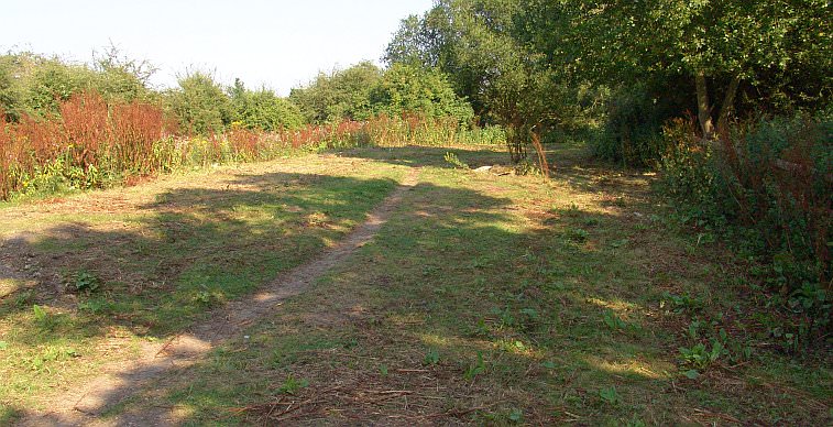
Further north the canal works become just a slight trace, and by the time the route reaches The Chase, that is it. There doesnt appear to be anymore of the Romford canal to see. Or is there??
Beyond The Chase there is a delightful walk along the River Rom. The river and valley twists and turns and it is a very narrow valley in places. This plus the fact that the final set of locks were to be situated along here meant that, as already discussed earlier, this section would have been very expensive to construct. Much further up, at the point where two paths intersect, there appears to be some slight evidence of canal works, but there’s nothing more until the outskirts of Romford is reached.

As one comes alongside the Gorseway (a road running off Rush Green Road) there is some evidence of the canal behind the houses sited on Gorseway. The River Rom is on the other side of the trees to the left. Not one map shows the canal route along here!
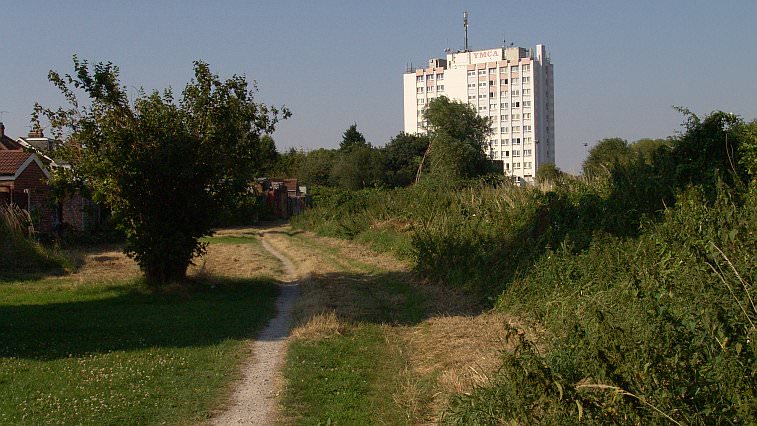
Looking the other way towards the Romford YMCA, the canal’s route is evident on the right in the undergrowth. The houses on Gorseway are to the left. I simply don’t know if there was any more canal beyond this point as development has removed any possible traces that may have existed.
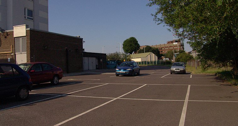
If one can squeeze under a very low pipe bridge and continue the journey, this is the YMCA’s car park. Presumably the canal (if it had ever been built as far as Rush Green Road) would have run straight across here, parallel to the River Rom on the east side as it heads north.
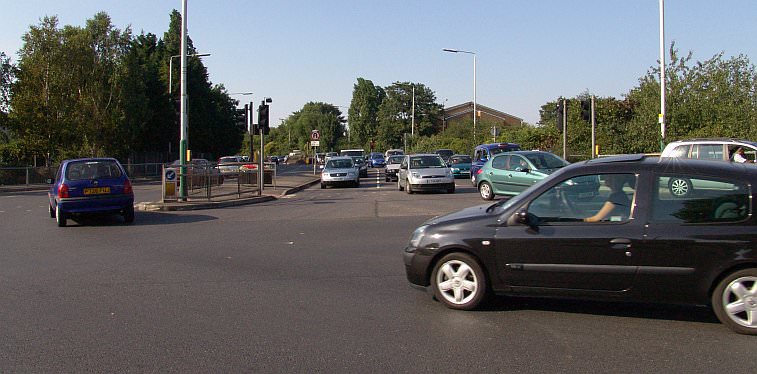
At this point any canal route must be hypothetical. The intersection between Rush Green Road and Rom Valley Way is a possible site for the canal’s alignment as it is opposite the YMCA car park and parallels the River Rom. The canal’s terminus near Romford railway station would have been about a third of a mile straight on, but whether any more canal was built is not known.
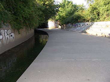
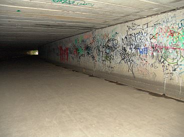
Directly opposite the road intersection the River Rom begins a subterranean route through some of Romford and this feature concludes with a glimpse of the artificial, man made waterway that exists north of Rush Green Road. It assumes a lengthy tunnel and is a graffiti artists paradise. Maybe someone has written on its concrete wall somewhere in the darkness of the long tunnel an epilogue that says: ‘The Romford Canal woz here…’
The Romford Canal pages:
Ford’s Works to New Road / River Beam to Beam Bridge lock / The lock to Rainham Road / Rainham Road to Elm Park / To the LTSR embankment / Into Romford