
London’s waterways history is comprehensively covered within these pages. Its simply an upgraded version of the older HTML site which began around 25 years ago.…
Continue Reading
The Basingstoke Canal’s lost section
The Basingstoke is one of those canals which has an interesting mixture of a waterway that is working, and a ‘lost’ or derelict section. Other…
Continue Reading
The Croydon and Rotherhithe Canal – Tracing the former route into Surrey
The canal’s full title to begin with was the Croydon and Rotherhithe Canal, in anticipation of a direct link to the Thames. The Croydon Canal,…
Continue Reading
The Fleet River and its Canal
The Fleet River must be the one and only natural river which enabled boats to reach any part of the inner metropolis of London, long…
Continue Reading
The Grand Surrey – the canal that aimed for Portsmouth…!
The Grand Surrey Canal …is the canal that aimed for Portsmouth but only got as far as Camberwell! An introduction to the Surrey Canal The…
Continue Reading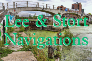
An introduction to the Lee Navigation (River Lea)
The Lee Navigation was actually built in stages from the 1600’s to the Mid 1800’s, with the main body of the work being undertaken in…
Continue Reading
The history of the place name known as 'Little Venice'
The ‘Little Venice’ facts that are ignored As most people will know, Little Venice is that well known area tucked away in W2 between Paddington…
Continue Reading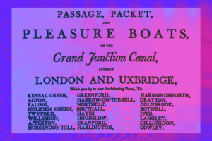
The Grand Union's Paddington Arm
The Padddington Arm of the Grand Union Canal (formerly the Grand Junction Canal) like all the Grand Union routes, was actually owned by the Regents…
Continue Reading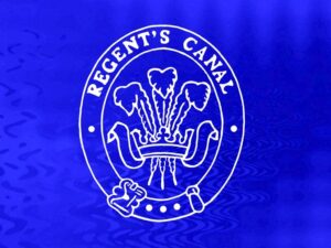
Regent's Canal intro & Little Venice – Maida Hill
The Regents Canal Following on the success of the Grand Union’s Paddington Branch, the Regents was opened to exploit the potentialities offered by water transport.…
Continue Reading
The Romford Canal
A waterway that took 65 years to plan & construct – and unfinished! The first plans for a canal to Romford were seen in 1809…
Continue Reading
The Slough arm 1
The Slough arm of the Grand Union Canal The 5 mile Slough Arm of the Grand Union Canal was opened in 1882. It has been…
Continue Reading