The Slough arm of the Grand Union Canal
The 5 mile Slough Arm of the Grand Union Canal was opened in 1882. It has been claimed as the last ever canal built in the UK. This is not entirely true, however one can say that it was the last traditional broad canal ever to be built by any of the old canal companies. In this case it was the Grand Junction Canal Company who instigated and built the Slough Arm. Brick, sand and gravel were its usual traffic. These were taken to London for its numerous construction projects.
The arm had a relatively easy working life until the 1960’s when traffic declined sharply, like on the rest of the waterways system. Closure came and Slough council wanted to fil lin the waterway, but this prompted the formation in 1968 of the Slough Canal group who fought to save it. The arm re-opened in 1975 as a remainder waterway, but now upgraded to cruising waterway status.
Most of the waterway is located in Berkshire however a short length from the Colne Valley to Cowley Peachey junction is within Greater London.
Slough basin is the furthest point (at 22 miles) on the long level of waterways that head westwards from Camden in Central London. That’s practically a whole day’s cruising!
This feature looks at the canal from Slough to Cowley Peachey. It begins rather unceremoniously in Slough, perhaps around a mile or so from the town centre and rail station. The entrance to the canal can be found on Stoke Road near the junction with the unusually named Shaggy Calf Lane. It can be easily missed because the site is in fact an industrial estate and the canal is not so apparent from the main road.
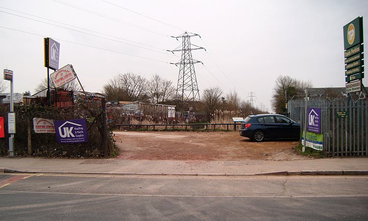
The canal entrance as seen from Stoke Road in the northern part of Slough, surrounded by industrial units & pylons.
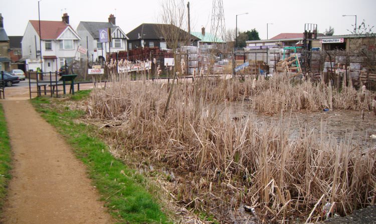
The very end of the canal. A somewhat dirty and uninviting prospect.
Nowhere to moor, too shallow, no rings. Not surprisingly boaters are the last to want to visit this part of the waterways.

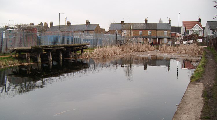
A view looking towards Cowley Peachey. The basin widens out for a bit, but even turning a 60 footer is difficult still.

The water however is quite clear and supports a surprising colony of wildlife. Towpath is well made for about a mile.
Pylons mark the route for the first mile or so and the Slough Arm is somewhat reminiscent of the lower parts of the Lee Navigation.

This is Wexham bridge (no.12)
Quite a bit of industry lines the canal on its south side. This includes factories, chemical works and a gas works.

Uxbridge Road bridge. It was enlightening to see this swan & shows the waterway manages to support wildlife quite well.

It is often said the Slough Arm only has one pair of stop gates – at Cowley Peachey. As this picture shows there are indeed other stop gates such as these by Bridge 11 in Slough. It shows how few bother to walk the arm fully in order to record its infrastructure!
From Uxbridge Road the towpath is no longer under the jurisdiction of Slough District Council. For the remainder of the way to Cowley Peachey the towpath is of the usual standards expected of our waterways. Mainly good, some sections fair, perhaps quite muddy after rain.

By Bloom Park is the first of the mileposts along the canal. One mile to the basin and four to Cowley Peachey.

Middle Green and St Mary’s bridges (nos 10 and 9) en route to Langley.

New housing on the south side of the canal near Middle Green bridge on land formerly used by Taylor Wimpey.

On the left, near St Mary’s bridge, is the last winding hole before Slough. This is as far as most boaters usually venture.

St Mary’s bridge (No.9) on the outskirts of Langley.
Next: Langley
Slough Arm Pages: Slough to Langley / Langley to the M25 / M25 to Cowley Peachey