A project initiated by the Greater London Council
By 1977 the towpath had been improved in the direction of Hackney. This made a grand total of five and half miles and this became the first section of the Greater London Council’s Canal Way Parks initiatitve. The gardens at Bonner Hall bridge were also created for the scheme. However it seems the section east of Islington tunnel was never officially embraced as part of Canal Way by the relevant boroughs (e.g. Hackney, Tower Hamlets) only the London boroughs to the west were active in bringing the project around.
Canal Way was not an official name until 1978 when the Greater London Council introduced its report and findings following these early schemes by Westminster, Camden and Islington. In that year the British Waterways Board lifted all restrictions on its towpaths. Previously access had been strongly restricted and those who desired to walk along the canals had to obtain a Towpath Walking Permit from the BWB. Opportunities in that year were envisaged on the creation of a new network of walking routes on an east-west axis across London.
 at Aberdeen Place on the route over top of Maida Hill tunnel")
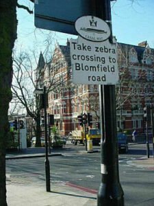
Canal Way signs (vanished during 2006) at Aberdeen Place on the route over top of Maida Hill tunnel.

The GLC councillors responsible for the Canalway scheme.
A series of booklets on London’s waterways and parks with comprehensive proposals for improvements in terms of visual environment and greater use of facilities such as towpaths led to the publication in 1978 of the GLC’s booklet ‘Canal Way Parks.’ This gave outline details of the brief and illustrated the various ways in which the local authorities and BWB could work together.
The GLC’s Planning Architect for Central London, Dr John Parker, concieved the project and although the name Canal Way Parks was used for the first couple of years it was soon dropped.

London’s Canal Way – the current extent of, and future proposals. 1978.
The GLC desired the Canal Way work would eventually be part of a comprehensive network of walkways in London. In the event this aspiration did not really come to fruitition until the establishment of the Jubilee Greenway Walk in 2012. Nevertheless in aspiration of such hopes the GLC renamed it as the the Canal Way Project in 1980.

Thornhill Bridge Community Gardens, Calledonian Road, King’s Cross. Originally a Canalway park built in 1981.

Canalway plaque in Penton Street, Islington, with a Jubilee Way marker in foreground. July 2013
Canal Way was not just about towpaths. It was hoped that a chain of ‘mini-pearls’ or small parks would be established along the Regent’s Canal. Sadly this was not realised, but not before those at Thornhill Bridge in Islington and on the west side of Bonner Hall Bridge in Hackney had been established during 1981.

Royal Borough of Kensington & Chelsea towpath marker as seen in 2013.
The section between Westbourne Park and Ladbroke Grove bridges formed the actual boundary between Westminster and Kensington & Chelsea, so despite the canal itself being in Westminster the towpath was witihn the Royal Borough of Kensington and Chelsea! In view of this unusual situation the RBKC devised its own towpath signs. A number of these were placed along the canal throughout the section to Ladbroke Grove and the only clue to these signs’ age is a reference to the long defunct ‘BWB!’

GLC’s full Canal Way proposals between Kensal Green and Limehouse. Click to view larger.
As seen from the above map, quite a few of the proposals were never begun, especially the off canal sites. The one at Mile End completed as a much later project by Tower Hamlets, whilst that at Meanwhile Gardens was undertaken by the Royal Borough of Kensington & Chelsea.
The local authorities invovled in the Canal Way scheme were as follows:
Inner London:
Hammersmith
Kensington & Chelsea
Westminster
Camden
Islington
Hackney
Tower Hamlets
Outer London:
Buckinghamshire CC
Hertfordshire CC
Beaconsfield DC (South Bucks DC in some documentation)
Three Rivers DC
LB Ealing
LB Hounslow
These councils were able to implement proposals and undertake projects as part of the Canal Way Project. The authorities from Camden westwards embraced the scheme more than the councils from Islington eastwards, which as a result means there are more remnants of the Canal Way scheme to be found on West London’s canals. However the section through Southall began with Canalway then migrated to its own local designs! Hounslow and Ealing also had signs denoting the Capital Ring.
Approval for schemes had to be sought from the GLC’s Arts and Recreation Committee. “All preparation, administration, design and contract management to be the reponsibility of the Borough or the proposing body.” Technically the latter included organisations such as BWB itself and the IWA, which could if they wished to, submit their own additional Canal Way schemes. The business address for Canal Way was: Dept for Recreation and the Arts, Room 673, County Hall, SE1.

Westminster’s substantial leaflet covering the towpaths in its borough – author’s collection
City of Westminster’s Canalway leaflet, produced in 1986, was perhaps the most substantial of all the guides for the London Canal towpaths. The simple reason being that the towpaths within its borough are clearly the most popular for tourists. A lovely map formed the entire rear of the leaflet covering the towpath from Harrow Road all the way to Prince Albert Road/Cumberland Turn in Regent’s Park.
 - author's collection")
London Visitor Convention Bureau/GLC Canal Way/BWB towpaths book (2nd edition 1985) – author’s collection
The BWB sticker on the above booklet was not an amendment, simply that it was accidentally omitted from the printing run!

The Canal Way booklet’s generous fold out map showing the six walks covered between Limehouse and Uxbridge.
Next: The Canal Way plaques


I am keen to discover what archival material there is on the GLC funding of these schemes. I live on an estate that lies between Cambridge Heath Rd (bridge) and Bonner Hall Bridge and the GLC funded purchase of land (ex-saw mill)at the junction of Waterloo Gdns and Sewardstone Rd to both ‘open up’ the canal side for local people and to build a community hall. Apparently these were separate pots of funding. This was around 1980. The land is also the site of Belmont Wharf (1840)and after refurbishment and a planning application battle (2004 to 2009) is the home for three permanent moorings. The leasees manage the Canal Club Gdns, https://en-gb.facebook.com/canal.club.community.garden/ http://www.towerhabitats.org/test/canal-club-garden-attracts-people-and-wildlife/
The garden is open on Tuesday afternoons between 3.30-6pm and for groups by appointment.
We are about to lose the gardens (and some play space) as LBTH is seeking the community hall land to ‘infill’ with social housing(rebuilding the community hall with flats on the top).
The gardens are an important variety of habitat on the south canal side and could be an impetus to expand pollinator friendly shrubs, climbers and plants in the gardens/yards between the bridges.
Memories, photos, help with research in planning etc archives all welcome… (LBTH planning dept earlier files still to be digitised but a no.are missing.)
Thanks for your message. The stuff I found was very basic and there’s very little on the GLC and how it funded these schemes, so I really don’t have any other information at hand. What I posted was for posterity or it would have been lost completely.