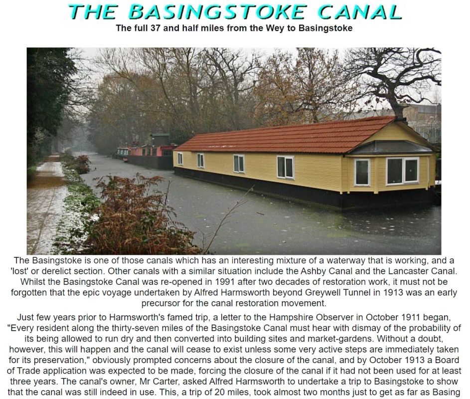
The Basingstoke is one of those canals which has an interesting mixture of a waterway that is working, and a ‘lost’ or derelict section. Other canals with a similar situation include the Ashby Canal and the Lancaster Canal. Whilst the Basingstoke Canal was re-opened in 1991 after two decades of restoration work, it must not be forgotten that the epic voyage undertaken by Alfred Harmsworth beyond Greywell Tunnel in 1913 was an early precursor for the canal restoration movement.
Just few years prior to Harmsworth’s famed trip, a letter to the Hampshire Observer in October 1911 began, “Every resident along the thirty-seven miles of the Basingstoke Canal must hear with dismay of the probability of its being allowed to run dry and then converted into building sites and market-gardens. Without a doubt, however, this will happen and the canal will cease to exist unless some very active steps are immediately taken for its preservation,” obviously prompted concerns about the closure of the canal, and by October 1913 a Board of Trade application was expected to be made, forcing the closure of the canal if it had not been used for at least three years.
The canal’s owner, Mr Carter, asked Alfred Harmsworth to undertake a trip to Basingstoke to show that the canal was still indeed in use. This, a trip of 20 miles, took almost two months just to get as far as Basing wharf and back, the last three miles of that taking up the better part of four weeks. The courts had fortunately by then decided that the canal was private property and therefore not subject to closure under the 1888 Railway and Canal Traffic Act. It is difficult to go back much further than these events in terms of the need for restoration.
Despite this epic voyage, eventually most of the top 5 miles of the canal was lost to redevelopment, beginning with the sale of Basingstoke Wharf in 1936, disposal of other sections for agriculture or houses, and ending with the severance of the route by the M3 at Hatch. The total length of the navigable section is just under 31 miles. The total length of canal was 37 and a quarter miles.
My association with the Basingstoke Canal goes back to the mid 1970s and I explored parts of it long before any restoration was undertaken. I have also been on the Deepcut and St Johns Digs and also knew Graham Palmer of the WRG quite well – as well as some others such as Peter Jackman of the SHCS. When Graham retired (this was due to ill health and he had to take on a lighter workload) he went to work for an insurance company on City Road in London. Strangely enough in those days I lived in one of the roads nearby (and a short walk from the Regent’s Canal) thus we used to bump into each other en route to or from, or even at the nearby tube station!
In the past I have referred to the following website (www.basingstokecanal1.freeserve.co.uk). This shows how long the Basingstoke Canal has been featured on London Canals! The site which was Basingstokecanal1.freeserve.co.uk unfortunately ceased in the autumn of 2003 when ill-heath forced the person looking after it to give up that work altogether. From December 2003 those pages became available at the Surrey and Hampshire Canal Society’s site – their website also has some other extra features on the Basingstoke.
The Basingstoke canal Authority’s site is at www.basingstoke-canal.co.uk and it offers links to other organisations and businesses linked to the Basingstoke Canal.
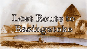
Introduction to London Canal’s previous coverage of the full 37 miles plus between Woodham and Basingstoke.
The reason these pages were withdrawn is because the pictures nor the content has been kept up to date as well as my having insufficient knowledge as to what is happening on the Basingstoke Canal between Woodham Junction and the Whitewater Aqueduct, as well as the five miles from Greywell to Basingstoke Festival Centre. That was a lot of pages! The original feature covering the 37 miles was shut down in 2010. A schoolteacher in Basingstoke contacted me in due course and requested the feature be put back up. That was in June 2014 and it lasted until 2017. The reason it was removed previously in 2017 is because the canal is not a London waterway despite the fact it could plausibly be just that by way of being London’s lost route to Basingstoke – the title of Paul Vine’s book – and with such a wide coverage and many pages not getting even any sort of update it was deemed easier to just keep the content within the Greater London area.
Other waterways such as the Wendover Arm, the Stort Navigation, the Royal Gunpowder Mills, the Wey Navigation and the Wey and Arun were removed too not just the Basingstoke. Thus keeping the this site London specific meant it was easier to maintain as there’s two others which need an awful lot of work to keep them current – clearly my enthusiasm is elsewhere thus London Canals hasn’t been as progressive as some would perhaps like. 2022 is the third time a feature on the Basingstoke canal has been restored to London Canals even though its just the lost five miles this time. The feature has a fresh look plus new images. It is very time consuming however.
The canal from Greywell to Basingstoke:
Originally the guide covered the 32 miles of walkable towpath, from the Wey Navigation to Greywell Tunnel plus the semi derelict section onwards to Penny Bridge and the five miles of lost canal into Basingstoke.
The Basingstoke Canal’s lost section officially begins at Penny Bridge where the jurdisction of the Canal Authority ends. Since the section of canal from Greywell westwards is in no way navigable, we begin the ‘lost section’ at Greywell itself. No boats have been through the tunnel since 1913, and although the tunnel collapsed in 1932, it was still passable by canoeists until further falls in the 1950’s. The tunnel was not directly responsible for the demise of the section westwards, although its collapse did accelerate that process. Despite concerns in 1911 after the last regular boats to Basingstoke ceased, that the canal would be filled in and the land used for other purposes, the first part of the canal to cease to exist was in the 1920’s when the short section of canal along the walls at Basing House was infilled. In 1927 a further loss occurred when Eastrop Bridge in Basingstoke was demolished. The wharf area was sold off in 1936 after the Greywell tunnel collapse made it clear no boats would ever reach Basingstoke again.
The lost section, having been dry since 1910 (except for a few weeks in late 1913 when Alfred Harmsworth’s attempt was made) was sold off beyond Penny Bridge for farmland, and used as a local cycle track from Swing Bridge Cottages (near Basing) to Basingstoke. The section from Greywell Road to the Hatch was cut by the M3 motorway. Other sections, by nature of being in substantial cuttings survived, such as the sections west of both tunnels, and the lengthy (but almost inaccessible) section that encircles modern day Basing.

Property demand in Basing has obliterated remains of the canal as sections are infilled and made level for estate. The section from Crown lane, approaching Basing House, was one of the earliest to be turned over to property and Musket Copse’s driveway is the canal’s alignment. The short section of cutting and overbridge in the grounds of Basing House remain, being part of that heritage site. Further properties have been built where the Broad Water was, and Red Bridge (or Slaughter bridge – after a local battle) remains, but is almost buried, whilst bungalows and gardens sit atop the former canal route.
Beyond Redbridge and Basingstoke’s Ringway East a good trace remains, including a culvert that takes the River Loddon under the canal embankment. However it is almost impossible to view this section because of undergrowth – apart from a short length which the Basingstoke Canal Heritage trail uses. When one views the canal alignment along the north side of Redbridge Lane, it must be remembered the road in fact encroaches upon part of the former canal alignment and what one is looking at is simply a narrower strip used as a route for electricity poles.
The canal in Basingstoke itself is now Eastrop Way, having been previously a cycle track to Basing. The town’s wharf frontage on Wote Street survived until the 1960’s when the New Market Square development saw it swept away. The wharf site had become a depot for the local omnibus company post-1936, and so it became the location for the first modern bus station in Basingstoke in the 1960’s. This has now in turn gone and been replaced by yet another new bus station completed in October 2002
From Penny Bridge eastwards to the site of the Greywell Tunnel west portal, the canal’s route is in good condition and has been restored to an extent, along with the Brickworks Arm, and the final few complete bridges remain along this section, being Eastrop Bridge (same name as the other in Basingstoke!) Slade Bridge and Brick Kiln Bridge.
It must be pointed out its not possible to walk on much of the former canal route beyond Penny Bridge, except where it forms the new Greywell Road, as well as part in the Basing House grounds, a bit on Redbridge lane itself plus along Eastrop Way in Basingstoke.
The canal remains at the rear of the properties fronting Cavalier Road in Basing but its difficult to see much of it. Its course however can be seen from the A30 at Basing at the rear of the car showrooms and then along the edge of a field before it turns westwards away out of sight.
Little Tunnel Bridge is now a listed structure and has been restored, but there are problems accessing the site. Basingstoke and Deane Council have created a heritage trail between Basing and Basingstoke.

We begin the lost section with a walk across Greywell Hill.
GREYWELL TO BASINGSTOKE PAGES:
Introduction / Greywell Hill / Tunnel – Brick Kiln Bridge / Penny Bridge – Frog Lane / Mapledurwell – Hatch / Old Basing Village / Basing House – Swing Bridge / Ringway – Basingstoke