Greywell Tunnel:
Greywell tunnel is or was 1232 yards long and the second longest in southern England. It opened in 1794 and the last boat through it was Alfred Harmsworth’s Basingstoke in 1913. In 1932 the tunnel had a major collapse and since a number of other minor ones. These block the watered two thirds of the tunnel (length 880 yards in stable chalk) to the east from the western section (which is built through clay.)
The diminutive western portal of the tunnel isn’t where it first ended. Around 25 yards of the bore has collapsed and is now open to the sky – thus the original portal has long vanished.
Here are some pics of the tunnel interior during an inspection trip:
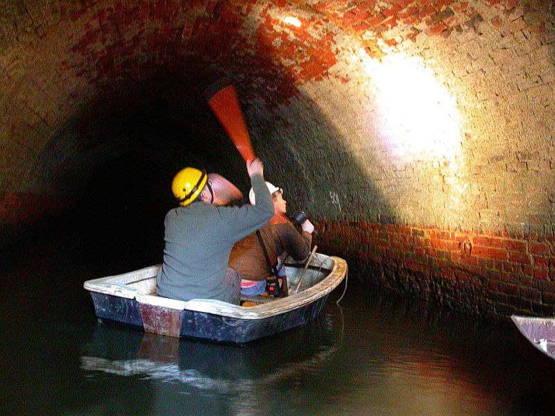
Inspecting the tunnel during the winter of 2015. Source: Facebook.
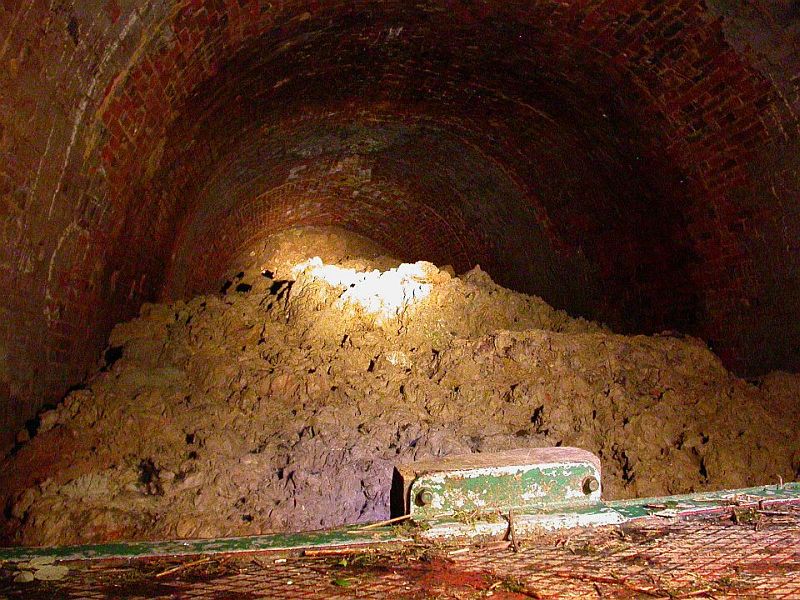
This is the point 800 yards in where the tunnel is blocked off completely by roof falls. Source: Facebook.
Inspecting the shorter western end section, this view is just inside the tunnel. More of that can be seen in the next few pictures. Source: Facebook.

The narrows where the tunnel portal originally stood. This end of the tunnel has disappeared by about 25 yards.

The portal at Greywell tunnel – pretty well secured!
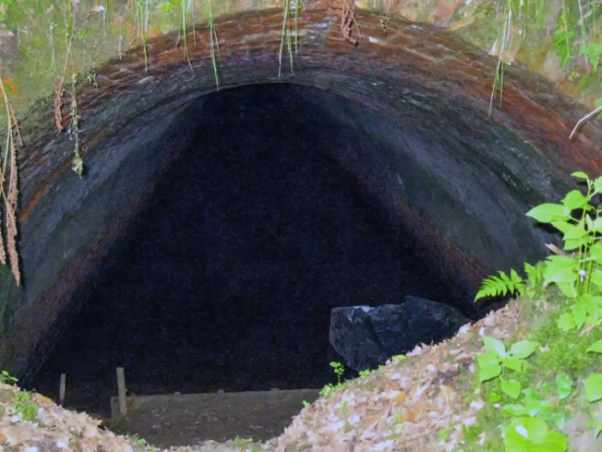
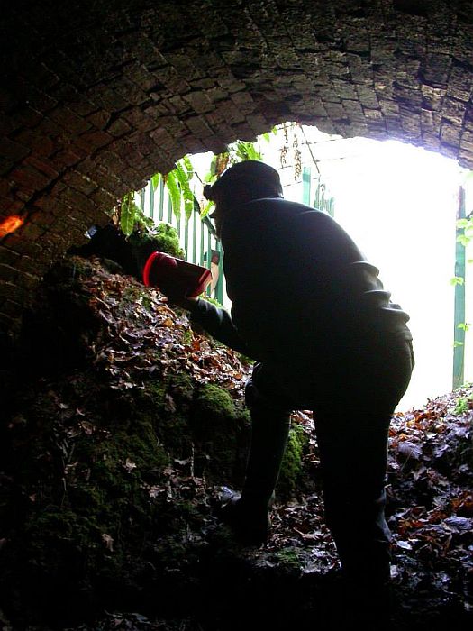
View inside the portal at Greywell tunnel 2009. One can just make out there’s a roof collapse perhaps ten metres or so into the tunnel.
West of the tunnel portal the canal is sited within a cutting that extends for the next 1.25 kilometres (nearly one mile) or so. Each of the bridges that cross this lengthy section are Grade II listed structures and no doubt its this that’s helped to keep this section in water and clear of any obstructions or developments.
Below is the first bridge on the western section – Eastrop Bridge. The very last bridge on the canal, in Basingstoke itself, was also called Eastrop bridge. This confusing state of affairs ceased when the one in Basingstoke was dropped and the canal underneath culverted in 1927.

Eastrop bridge in Up Nately still stands, its twin structure in Basingstoke was demolished in the 1920’s. The bridge has been restored as it is a Grade II listed structure.
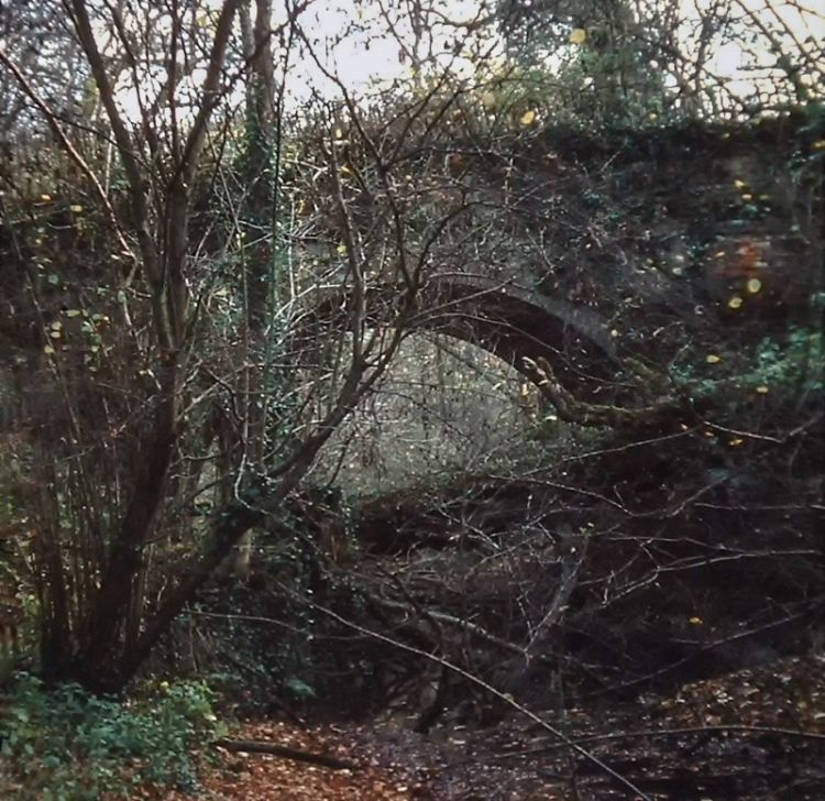
This is Eastrop bridge more than forty years ago! When I took this picture the canal bed was most overgrown and the bridge didn’t have a parapet at all. That explains the temporary fencing which can be seen. It did not become a listed structure until 1984.
Heritage England listing for Eastrop Bridge at Heather Row Lane.

The canal between Eastrop and Slade bridges.

The next bridge westwards from Eastrop Bridge is known as Slade (or Slades) Bridge, this view looks eastwards. This is also a Grade II listed structure.
Heritage England listing for Slades Bridge at Heather Lane.

Brickworks Arm crossing. The footbridge takes the towpath across the arm leading to Nately Brickworks, the main canal itself turning sharply southwards away to the left.
At this point there used to be a lift bridge. The arm was last used possibly as early as 1901 (however another official account suggests 1908) and from then traffic west of Greywell declined considerably, all traffic ceasing by October 1910, and three years later the very last commercial boat – appropriately ‘Basingstoke’ – on Alfred Harmsworth’s epic voyage in 1913. This does not discount the possibility that maintenance boats may have traversed the tunnel and along the canal as far as Brick Kiln Bridge – where the stop planks marked the end of the canal’s navigable section from 1910 to 1932 – until the tunnel’s collapse in that year prevented any further passage.

The information board at the entrance to the Brickworks Arm. The inset picture features two narrowboats at the western portal of Little Tunnel about 1900.


Views of the Brickworks Arm, with the attractive cottage that now stands on the site of the brickworks (above left) The basin was raised at one side with a retaining brick wall, and on the opposite side (as shown above right) the basin was brick lined too. I suppose it was easy to make copious use of bricks at this location.
BRICKWORKS ARM – PENNY BRIDGE:

A view looking along the Basingstoke Canal from the Brickworks Arm footbridge towards Up Nately.

Despite the canal’s proximity in Up Nately, there has been virtually no sign of the village itself until now. These new houses give Up Nately a visible presence along the canal.

A view looking towards Brick Kiln Bridge. Its Grade II listed.
Historic England Listing for Brick Kiln Bridge at Bladestock Lane.
This stretch of the canal parallels the main street in Up Nately, but one wouldn’t think otherwise. Those using the road through the village may spot the tops of the bridges on the north side. It was at this point that the Basingstoke Canal was stopped off in 1910 when it was decided it was no longer worth maintaining the section westwards. Brick Kiln bridge is where the lengthy cutting westwards from the tunnel ends, and its just a short distance westwards to the end of the watered canal at Penny Bridge.

Next: Penny Bridge – Frog Lane.
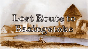
GREYWELL TO BASINGSTOKE PAGES:
Introduction / Greywell Hill / Tunnel – Brick Kiln Bridge / Penny Bridge – Frog Lane / Mapledurwell – Hatch / Old Basing Village / Basing House – Swing Bridge / Ringway – Basingstoke