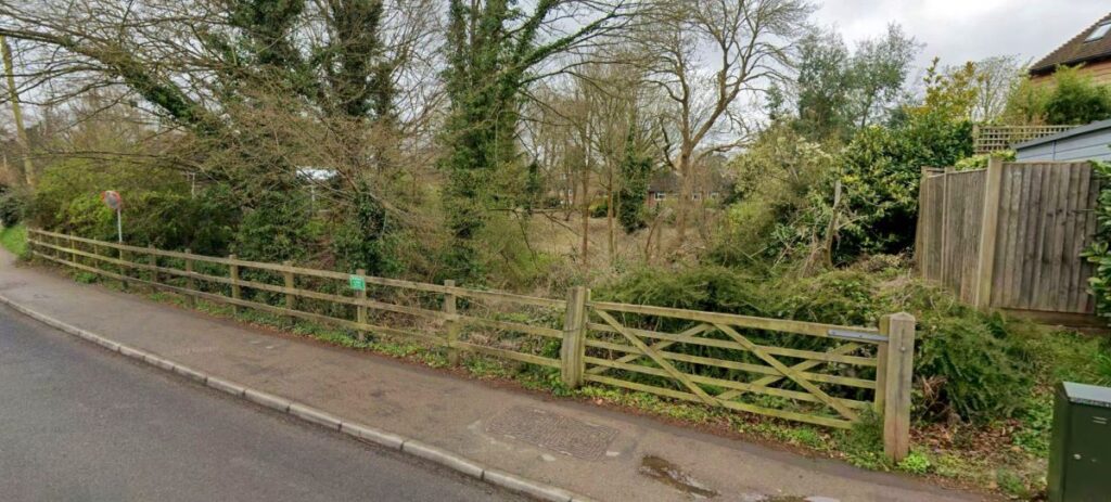
After the M3, the canal sweeps round in a long arc, almost encircling The Hatch, to enter Basing in a north easterly direction. It passses through a new housing development that has just been opened (2001) opposite Rainbow Close, just off the A30. The route then passes through Rainbow Close and beyond the far side of the houses here it passed what is now the site of a new house and electricity substation before crossing Hatch Lane where a pronounced rise from the A30 junction can be seen.

Rainbow Close looking from the A30 north eastwards along the canal’s alignment.
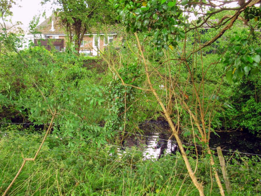
To the right, looking over a garden wall one can look down onto a well preserved section of canal.

Old Basing – House on the left is built on canal route.

The well preserved section of canal at Old Basing, off Hatch Lane. This state of affairs is all too short as the canal’s course is totally obliterated beneath gardens stretching off Belle Vue and Cavalier Roads, although the eastern boundary of the canal survives as trees and hedgegrows in places, as will be seen from the car showrooms complex just off the A30 at The Hatch.
Past the car showrooms at The Hatch, the canal’s course can be discerned quite easily from the A30, although the first part is actually gardens off Cavalier Road. The canal’s course is essentially dry and overgrown but is soon back in water and enters a substantially long and deep cutting. Before it enters this deep cutting the watercourse runs to the rear of properties in Cavalier Road.
One can get round to the rear of Basing village as there is a public footpath to this area. However the path veers a long way from the canal itself thus any attempt to view the canal is quite problematic. Its rather hardcore exploring really if anyone tries to view this section. I did it merely because I wanted to know if the canal still existed – and the good thing is at least it hasn’t been filled in.
Waterways Properties:
One wonders what exactly is the canal purpose hereabouts. Its not a stretch of waterway that can be restored by any means because it hasn’t got any merit that could be worth that effort. If there had been other stretches available on either side (eg towards Mapledurwell and towards Basing House) there would have been every reason to restore this section. As it stands even though this section is the ONLY complete watered stretch of canal between Penny Bridge and Basingstoke around 800 metres (just over half a mile) yet it has virtually no potential because of the deep cuttings and difficulty of access.
Clearly at one time however there was someone who had a view to the potentiality of this watered stretch of the Basingstoke canal. Research shows at one time this lengthy section from Milkingpen Lane to The Hatch belonged to a company called Waterways Properties Limited. There’s very little on this company but it appears it may have bought this length (and its adjoining lands) sometime in the late 1960s from the New Basingstoke Canal Company Limited. I would think the construction of the M3 from 1968 onward put paid to any plans that Waterways Properties might have had. There used to be notices along the canal saying ‘Private Waterways Properties Ltd,’ although none of these now exist.
If one stays on the public footpath the canal’s course can be quite well seen across the fields as it traverses its way round the back of Basing. The path extends off a service road that leads to the railway and this can be seen on Google Streets.
The Basingstoke Canal at the rear of properties in Cavalier Road. The watered but overgrown channel runs along the bottom of the gardens.

Spoil heaps seen near the railway line – the canal still exists in a deep cutting to the left. This was dug in the 1790s and the spoil deposited along the sides, making the cutting look twice as deep as it really is.
Above picture: This is a view from near the railway line, looking south east. The excavations for the deep cutting back in the 1790’s has left a spoil heap that stretches almost back to the previous picture. The cutting is quite deep, and the spoil gives the impression the cutting is even deeper.
The Basingstoke canal seen in its deep cutting at the rear of Basing.
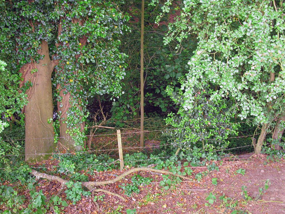
Although this section is difficult to access there are some points at which this section can be observed, by using a track that veers off to the east (Google) at Milkingpen Lane, where it meets the railway bridge, and fighting through undergrowth in the woodland as far as a barbed wire fence, so as to gain the perspective to the south east.

On Milkingpen Lane, south of the railway, the canal passed under the road at what was known as Cuckoo Bridge. Milkingpen House (above) is on the canal’s alignment, and it is clear the lengthy cutting along here has been filled in completely. Cuckoo Bridge House (below) is a reminder of the canal’s existence. The plaque is affixed to an older, but substantial building south of the canal’s actual alignment. Looking over the other side of Milkingpen Lane, directly opposite the new property, one can peer down through the undergrowth onto a section, as yet undeveloped, of the former canal cutting. As described later one can also access this section of the canal.
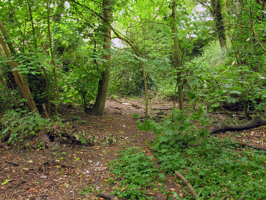
Overgrown canal bed at bottom of cutting just south of the site of Cuckoo Bridge, Milkingpen Lane, looking in the direction of Basing House.
If one wonders where this bit is it can be seen on Google Streets. There is a fence here and the gate is evidently locked however one can simply access the site by walking the other side of the gate which is what the locals do too! Source: Google Streets.

The parapet seen here on the right is all that is visible of Church Lane bridge, just off Milkingpen Lane. The bridge is still there but almost buried. The other parapet has been demolished to create an access drive to the Vicarage on the other side of Church Lane.
Properties situated off Milkingpen Lane in Basing, where the old vicarage used to be, is known as The Mead and it is actually on the line of the Basingstoke Canal. The canal was in a cutting and like other parts of Basing, it has been made to level with the surrounding land.

By this cottage at the far end of Church Lane is the footpath that leads past the cemetery to Crown Lane, and also follows the canal alignment past the site of Basing wharf.

The footpath from Church Lane to Crown lane. This quiet path runs alongside an extension to the local cemetery but on the left hand side, behind the wooden fence, stood Basing Wharf. The wharf was in a widened section of cutting and this path actually ran along the edge of the wharf as old maps show.

Site of Crown Lane Bridge looking in Greywell direction.
Crown Lane Bridge – no longer there but a slight hump reveals where it once stood. Of course, it may still be buried under the road, as research shows that at one time, only the parapet remained (like at Church Lane) but being so much lower, it actually formed the kerb of this part of the pavement on Crown Lane!
Redevelopment and road improvements have seen this unusual state of affairs swept away. On the other side of Crown Lane can be seen Musket Copse. This private road is the canal’s actual alignment. The houses were built in the 1970’s when the cutting was filled and levelled. At one time it would have been possible to stand somewhere along here and looking along the canal cutting, view Basing House bridge, which is about where the centre of the picture is – perhaps 200 yds away.
None of the cutting remains until one reaches Basing House Bridge itself. Both views (above and below) are taken looking along the canal’s alignment. It came under Crown Lane diagonally, and Basing Wharf was sited to the left in the above view.

Musket Copse, Basing. Beyond here is Basing House itself.
Next: Basing House to Swing Bridge Cottages.
GREYWELL TO BASINGSTOKE PAGES:
Introduction / Greywell Hill / Tunnel – Brick Kiln Bridge / Penny Bridge – Frog Lane / Mapledurwell – Hatch / Old Basing Village / Basing House – Swing Bridge / Ringway – Basingstoke