The route continues from the west side of Up Nately and the end of the watered section of the Basingstoke canal at Penny bridge is soon reached. From Penny Bridge westward there’s little left of the Basingstoke Canal save for a substantial but inaccessible stretch around the northern perimeter of Basing village.

End of canal at Penny Bridge – and just a few hundred yards beyond this point is Little Tunnel.
This is the end of the Basingstoke Canal, as we know it, at Penny (or Penney) Bridge, although there is no such bridge now. From here to Basingstoke is about four miles or so, but the going is quite difficult, and detours have to be made where the canal route is no longer available.
Only the new Greywell Road at Mapledurwell, the section along Basing House walls, a section just before Ringway East, and Eastrop Way in Basingstoke itself are the those parts of the canal’s route that can be easily walked. Just across the fields from the Penny bridge site, the M3 motorway is plainly visible to towpath walkers.

The new Penny Bridge information board, declaring this is the Up Nately Nature Reserve.

Where Penny Bridge stood. The red arrow indicates the line of canal heading west towards Little Tunnel. The red oval indicates the rather inconspicuous entrance to the canal’s towpath.
Little Tunnel:
I am aware from others who have made this walk in recent years the area around Little Tunnel is more difficult to access. Even though there are no signs denoting this its not public property and the local farmer probably wont allow access unless permission has been sought. Its probably because the entire site is now a complete working field rather than one that was divided by the old canal.

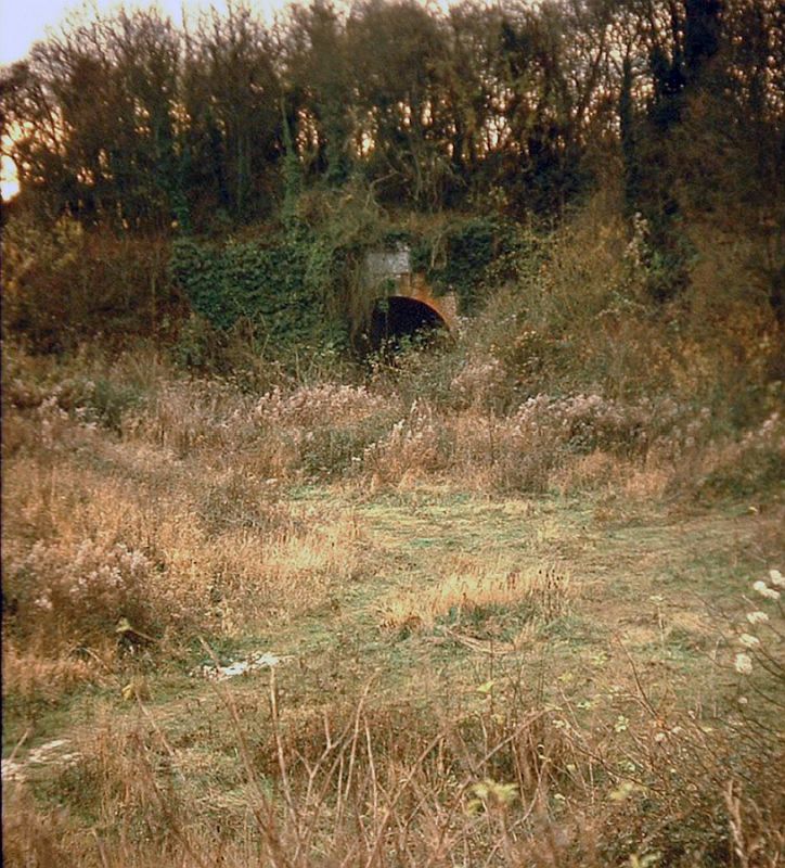
A view looking at the canal route from the bridleway at the top of Andwell Drove. Penny bridge is within the trees at left and Little tunnel is off picture at right. One can just make out the canal’s embankment.
The canal once traversed this location on a small embankment that lay between Penny bridge and the tunnel. It is not generally known however the canal crossed a valley on either side of Little Tunnel. In days gone by it was possible to walk along the towpath/canal bed through Little Tunnel to Frog Lane but not without a struggle. Now its impossible.
Just for comparison here’s a Google Streets view of the canal alignment as seen from Greywell Road. It clear the canal embankment has been flattened somewhat on the approaches to the tunnel. Its likely a means of affording a more level access into the adjacent fields and is confirmed by the following picture I took in 2009.

Straight ahead, behind the haystacked trailers, and where the clump of trees sit atop the hill, is the location of Little Tunnel. The picture is taken looking along the canal alignment towards Little Tunnel & Basingstoke. Compared to the 1980s the canal’s profile is now very much flattened and the cutting leading to the tunnel itself has been backfilled considerably.
A short distance further on one would have been greeted by the sight of the tunnel itself. Now this view is impossible too because the entire site has been filled to create a much larger field. The canal bed was still quite well defined in this picture I took during 1981
Although it was officially called Little Tunnel Bridge being just 50 yards, it went through the ground therefore it was a proper tunnel. The road above it used to be known as Andwell Drove.
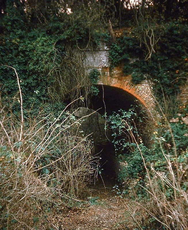
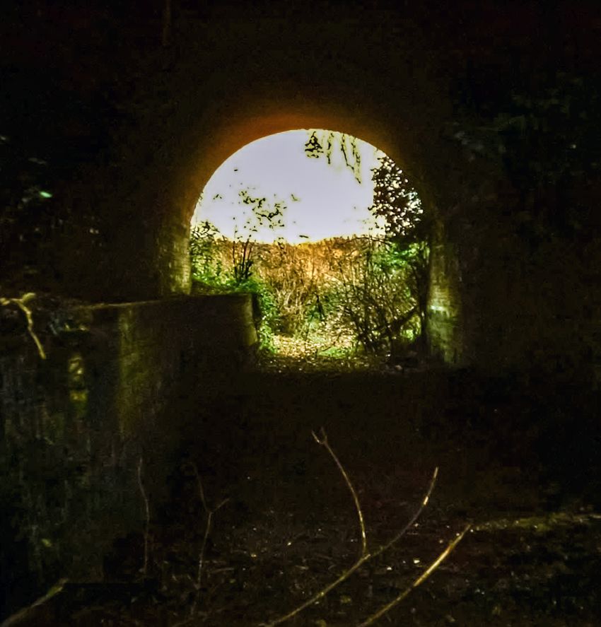
Little Tunnel in 1981 I took a number of pictures of the eastern portal standing on the bed of the canal. This part has since been filled in almost right up to the portal itself hence the canal bed profile is no longer visible. I always wonder why the tunnel had a area of white painted above the portal maybe there was a notice or something at one time?
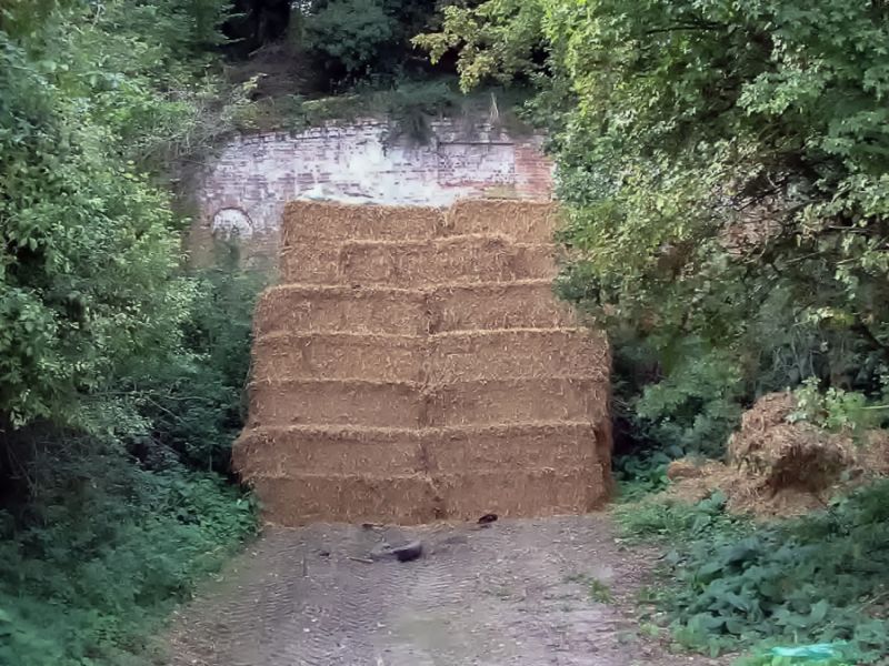
Little Tunnel 2002. The tunnel was stuffed completely with hay bales!
In the earlier photos one can see its a tunnel entrance but not the entire portal at all because it was so overgrown. However the 2002 picture shows the tunnel was built in the style of the portal at Greywell as well as the bridges at Up Nately.
The portals were restored some years ago (prob 1980s/1990s). The structure is a grade 2 listed building and was approved as such in 1977. Its not known why the structure was approved originally – it may have been a means of securing the former canal route through here towards Basingstoke. The listing merely tells us the tunnel was approved because of ‘its special architectural or historic interest.’
Historic England listing – Little Tunnel Bridge + Andwell Drove.
Little Tunnel as seen from its western end in 1981 just before I walked along the canal bed from here to Frog Lane. There was a stop gate of sorts at this end of the tunnel.
The tunnel in 1981 looked precarious and in danger of falling down, and I suppose it was such a state of affairs that prompted it to be listed, and subsequently restored to a certain standard. As mentioned earlier, it was still possible to walk to Frog Lane, although the canal bed was extremely overgrown in places – the towpath having long ceased to be well defined.


Above left: The picture featured on the information board at Up Nately brickworks arm can be seen here, below right, and it is interesting because it shows the boats, Ada and Maudie, at the tunnel’s western portal in about 1900. It is clear from this picture that the canal westwards of Greywell did not see much traffic considering the state of navigation. Persistent leaks in this section caused it to be stopped off at Brick Kiln bridge in the early 1900’s after the last traffic to Basingstoke had ceased.
Above right: I did this picture some years ago, a composite of other Basingstoke scenes onto the Little Tunnel approach. This shows what the scene would have looked like today if the Basingstoke canal was still in existence here. Compare with the picture (shown earlier in page) looking along the farm track towards the tunnel site.
More information on Little Tunnel from Subterranea Britannica.

Just off the junction with Greywell Road and Frog Lane is this access road to this smart new estate, known appropriately as Canal Reach. The houses at the far end are built overlooking the very overgrown canal cutting that leads westwards from Little Tunnel.
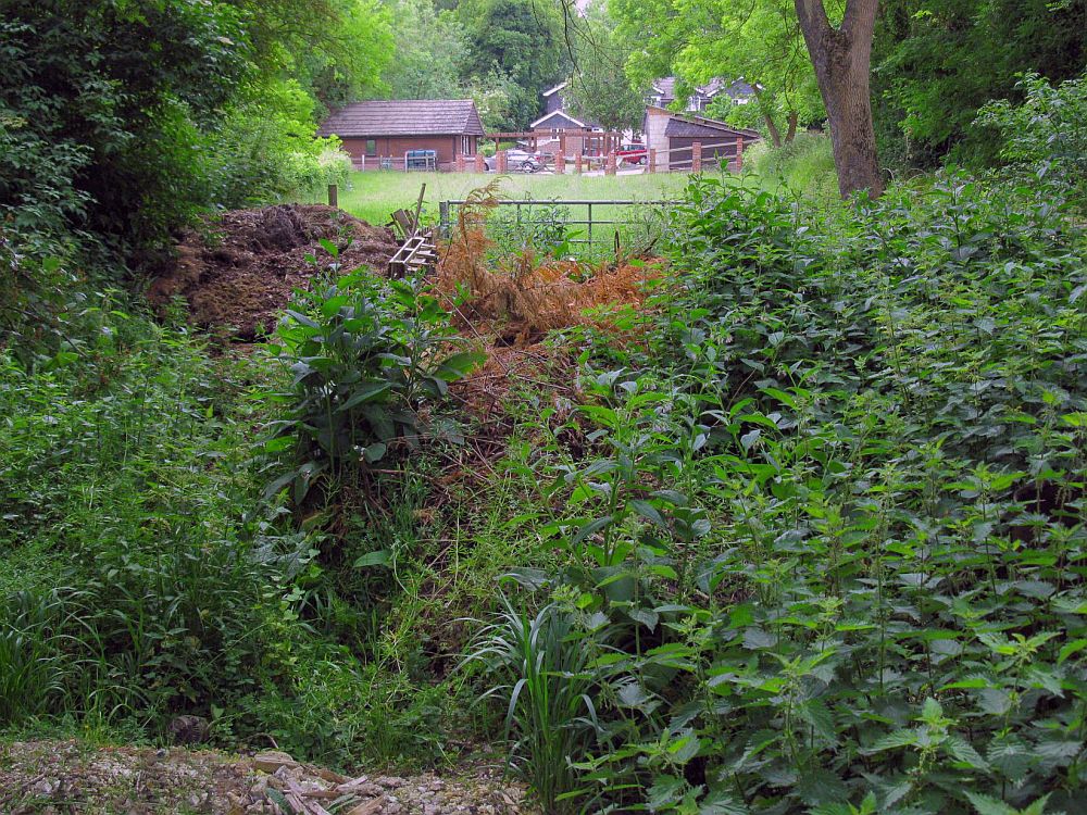
A view from the remains of the canal bed looking towards the Eastside Coach House.
The only visible trace of the canal near Mapledurwell is at the rear of property along a short lane/footpath that leads eastwards off Frog Lane (from where the former swing bridge once stood.) The former canal route can be seen as a grassed area at the rear of the Eastside Coach House. The Eastside Coach House literature explains that it is “a spacious house on the original route of Basingstoke Canal with Little Tunnel a short walk from the rear of the garden.” Frog Lane is the road that leads from Greywell Road southwards

Site of Frog Lane swing bridge. Just about where the dog is, the canal passed right to left going to Basingstoke, and at this point once existed Frog Lane swing bridge! Difficult to imagine such a canal scene now.
Next: Mapledurwell to Hatch.
GREYWELL TO BASINGSTOKE PAGES:
Introduction / Greywell Hill / Tunnel – Brick Kiln Bridge / Penny Bridge – Frog Lane / Mapledurwell – Hatch / Old Basing Village / Basing House – Swing Bridge / Ringway – Basingstoke