Nearer to Basingstoke, the canal route remains quite traceable, but not for very long. After crossing the River Loddon (there was never an aqueduct at this point, just a simple culvert which still exists.) the canal loops back to the north east on the other side of the valley where Swing Bridge Cottages are. The Basingstoke Canal heritage trail bisects the river valley and crosses Basing Fen to emerge on a rather untidy piece of heathland with Basingstoke’s office blocks prominent towards the west.
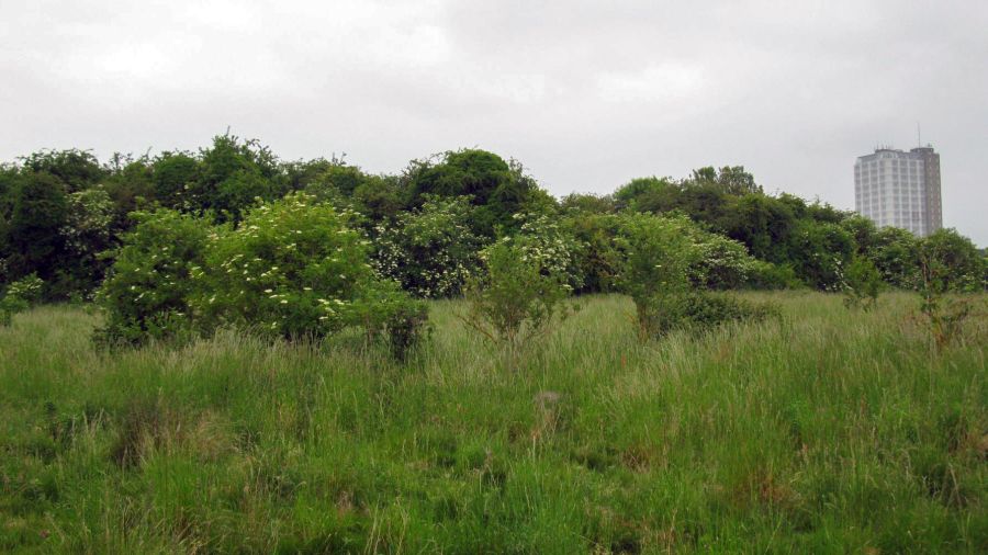
The canal route marked by trees near Ringway East.
The tall building is the AA’s headquarters and its known as Fanum House. It has a claim to be the tallest building between London and New York!
The canal’s alignment is within these trees ahead, and the heritage trail enters the trees to run along the former canal itself. This section is the very last substantial length of the former canal still in existence nearest to Basingstoke.
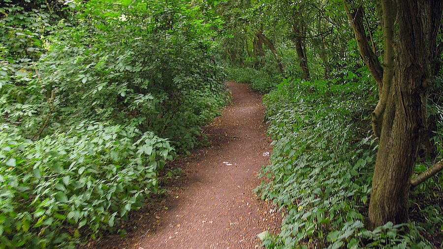
The Basingstoke Canal Heritage trail uses the actual canal alignment for a short distance.
The route of the Basingstoke Canal Heritage Trail on the canal’s course itself, with the access gate onto the canal just out of sight in the undergrowth. In the 1960’s when this section was used as a cycle path, the canal’s course was well defined with trees and hedges bordering the route on either side. Now it is a jungle and it can be a struggle to explore the section to the south away from the heritage path. At the far end, the canal’s route ends abruptly as it meets the large loop that forms off Ringway East to connect with Churchill Way.
Beyond here there is very very little left to see of the canal itself. All that remains is the former alignment on the other side of the Ringway as used, initially, as a cycle path, and then as Eastrop Way. The outer circle of this loop by Churchill Way is a cycle and pedestrian route, and once one is out of this gate its a left turn along the cycle & pedestrian route in order to walk along the canal’s alignment into Basingstoke itself.
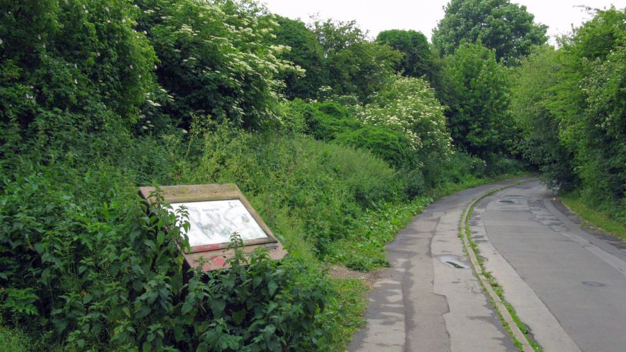
The canal heritage trail looking towards Basingstoke. The northern canal boundary of the canal was just to the left of the road. Both routes merge at the nearby bridge as shown below.

This is the end of the canal as it loops round from the Loddon valley to meet Churchill Way. This view looking eastwards is along the canal’s alignment, though it no longer exists here. The red line shows the approximate northern boundary of the canal from the heritage trail information board. It turned to the right at the point where the bridge abutments are towards Eastrop Way. The underpass (below) is certainly the pedestrian route from the canal at Churchill Way to Eastrop Way but it is slightly to the north of the canal, whose alignment is now under the Ringway East itself to the left of the picture.
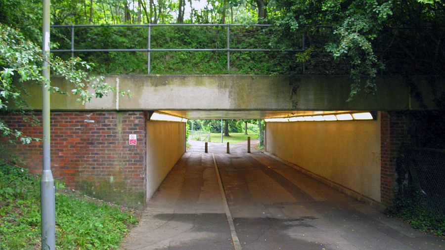
Ringway underpass gives access to the next section towards Eastrop Way.
DO NOT USE THE ROUTE THROUGH EASTROP PARK!! THIS IS NOT THE FORMER ROUTE OF THE BASINGSTOKE CANAL!

Looking from the Ringway underpass towards Eastrop Way. The heritage train follows the direct pathway into Eastrop Park. Actually the canal was further to the south – its north boundary is marked by the red line in the background. The red arrow indicates the correct route to gain access to the canal alignment.
We now come to the final section of the Basingstoke Canal. The route of the canal, after it was sold off, remained as an access track off Eastrop Lane for farmers, and subsequently also as a cycle lane to Basing. In 1961, major developments began to take place in Basingstoke and the surrounding area, with roads being added or altered. The (then) new Basingstoke Bus Station was built on the actual site of Basingstoke Wharf, although the frontage to the wharf itself on Wote Street, remained a little longer until the New market development took place. The track that extended along the canal route eastwards of course became Eastrop Way itself. It is doubtful if any orignal trees along the canal’s alignment remain – with the exception of possibly just one.
As for Basingstoke itself, the last bridge at Eastrop Lane, was dropped and the canal culverted in 1927. Basingstoke Wharf was sold off in 1936 and soon became a depot for the local bus company. In 2002, the centre of Basingstoke has changed once again, and the bus station of 1961 has been swept away, replaced by a new bus station aligned south to north, although its southern end is still on the location of part of the actual wharf. If one walks through Eastrop Park on the south side, the slopes that carried the canal’ s route above the valley of the River Loddon can still be seen in places. However, the canal’s actual alignment is now Eastrop Way.

View along canal alignment towards Basingstoke.
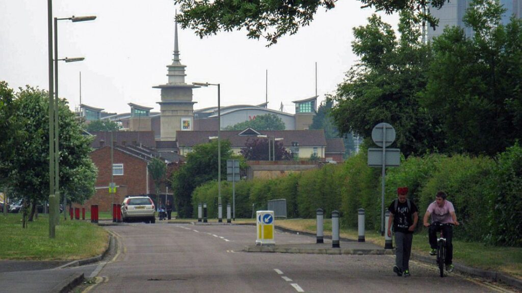
This view looks west to the Roger Morris sports centre in the direction of Basingstoke. The trees on both sides mark the canal’s approximate boundaries. Beyond the Sports Centre, the canal route becomes Eastrop Way.

Eastrop Way looking towards Basingstoke. The canal towpath was on the right and it ran past this tree.
Was this tree there when the canal existed? Its definitely an old tree and certainly although all the trees that lined the canal were chopped down, aerial photographs from Hampshire Council show one tree that stood slightly back in relation to the other trees at this location. Is this the same tree? Its been marked red in the picture below. In the distance is the ‘spire’ of Basingstoke’s new Festival Place (completed October 2002). Note: There is now a hedge along the full length of Eastrop Way, so this older picture is being used as it illustrates the tree’s situation clearly.

The course of the canal towards Basingstoke in the early 1960s. It had now become a farm track.
Despite the canal having been infilled, its tree lined course is still clearly apparent in the above picture from around the early 1960’s. The remains of the canal’s route clearly existed as far as the site of Eastrop bridge and on the OS map of 1961 it says ‘Basingstoke Canal (disused)’ What was farmland is now Eastrop Park (on the right) and the land to the left is now the Eastrop estate. The aerial picture shows that Eastrop Way’s alignment follows the canal’s course exactly. With strong evidence like this, one wonders why the former canal route needs to be touted as being in Eastrop Park?
Eastrop Way – the course of the former canal as it heads towards the centre of Basingstoke. The two guys are by the tree that has just been discussed.

This curve in Eastrop Way shows the canal’s last sweeping curve into Basingstoke. At the far end of the curve it passed under Eastrop bridge and thence into the wharf area.

The railings with flowers on top (middle of picture) marks the site of Eastrop Bridge.
Further along, nearer to Basingstoke, modern buildings make themselves more prominent, as seen above. The Basingstoke Canal’s last curves into the town are reflected here by the alignment of the present Eastrop Way. The grass verge on the right would have once been the towpath itself, whilst the hedge along it mark the canal’s northern boundary.
One of the reasons for the removal the Basingstoke Canal from the bridge to the wharf in 1936 appears to have been because it was a very popular dumping ground for animal corpses. The smell must have been intolerable at times and it seems the remedy was to remove Eastrop bridge and infill the canal. When the canal was built the area was known as Eastropland.

Just off Eastrop Way at the point where it meets Eastrop Lane, is this Basingstoke Canal heritage trail board, marking the site of Eastrop bridge. The actual bridge was to the right of the picture.
The heritage trail takes one through Eastrop Park and although it does follow the canal’s route, it is not the actual canal’s alignment however. This is not made clear on neither the information boards or the Heritage Trail leaflets. Where the hedge is, what was the canal’s northern flank can be seen where its banks once sloped down to the shallow, broad valley of the River Loddon. Eastrop Park itself now takes up much of this former river valley and little trace of the river’s original course is left.

These plaques, including a Basingstoke Canal shilling, remind one of the canal’s existence. However, the plaques are not really on the canal route and this only serve to reinforce the notion amongst Basingstoke residents that the canal went through Eastrop Park – one teacher from a Basingstoke school told me it was ‘common knowledge’ in the area’s schools the Basingstoke Canal’s route was through Eastrop Park.
I showed her the aerial picture of the canal in the 1960’s – and it was very clear to her that Eastrop Way is without a doubt the actual canal route. It seems that people do not picture an old canal becoming a road, but its certainly a fairly regular occurrence on the lost section of the Basingstoke, as well as a number of other closed canals around the country.
Postscript Jan 2010: I have checked Basingstoke & Deane’s online information and it seems a rather mixed bag with regards to the canal route. Their pdf document on Eastrop Park tells us the ‘old canal boundary hedge continues to run along the southern edge of Eastrop Park‘ and while that is correct, their Basingstoke Canal Heritage Footpath leaflet tells us the canal’s footpath ‘runs east through Eastrop Park.‘ It also mentions the boundary hedge but does not explain where the canal actually was.
This information does lead people to assume it was in Eastrop Park. Basingstoke East Scout District’s information sheet (published 15/03/09) shows the classic error – that the “remains of the canal can be seen running through Eastrop Park.” It seems it is taking time for information to filter through regarding the correct alignment of the canal into Basingstoke.
NOTE: The Basingstoke East Scouts leaflet (and the website) is no longer available.
NOTE: The old leaflet on Eastrop Park no longer exists at the council’s website however The Internet Archive has a copy.

View from the gyratory road of the Eastrop Bridge area. Immediately the canal came through the bridge it entered Basingstoke Wharf. The red arrow shows the line of canal from the site of Eastrop bridge into Basingstoke Wharf.

View looking towards the site of Basingstoke Wharf.

The only other mention of the canal other than the plaques is this illuminated deco underneath the gyratory road bridge.

This view looks along the old access road to the old bus station. This now forms the exit road from the new bus station! This view would have at one time looked from a point to the west of Eastrop Bridge, approximately where the timber merchants, E C White & Sons stood, towards the end of Basingstoke Wharf and of course, the furthest extremity of the Basingstoke Canal. Paralleling the canal would have been the old Goat Lane.

Basingstoke Bus Station and Festival Centre in October 2002.
The new 2002 bus station. that has replaced the original 1961 bus station. Although the new bus station is smaller, the wharf once stood where this view now looks southwards to the new Festival Place shopping centre.

To stave off some of the confusion regarding the canal’s route into Basingstoke, this map shows the entire Basingstoke canal alignment between Basing House (top right) and the town centre (left.) As it clearly shows, Eastrop Way is the actual route.
Basingstoke & Deane Borough Council had a consultation in 1995, the objective was to bring the Basingstoke Canal back to the town in conjunction with new development. Costs were abortive, something like 27 million at 1995 prices.

The map showing options for restoring the canal to Basingstoke. The various proposals included aqueducts over the motorway and a new Greywell tunnel.
GREYWELL TO BASINGSTOKE PAGES:
Introduction / Greywell Hill / Tunnel – Brick Kiln Bridge / Penny Bridge – Frog Lane / Mapledurwell – Hatch / Old Basing Village / Basing House – Swing Bridge / Ringway – Basingstoke